
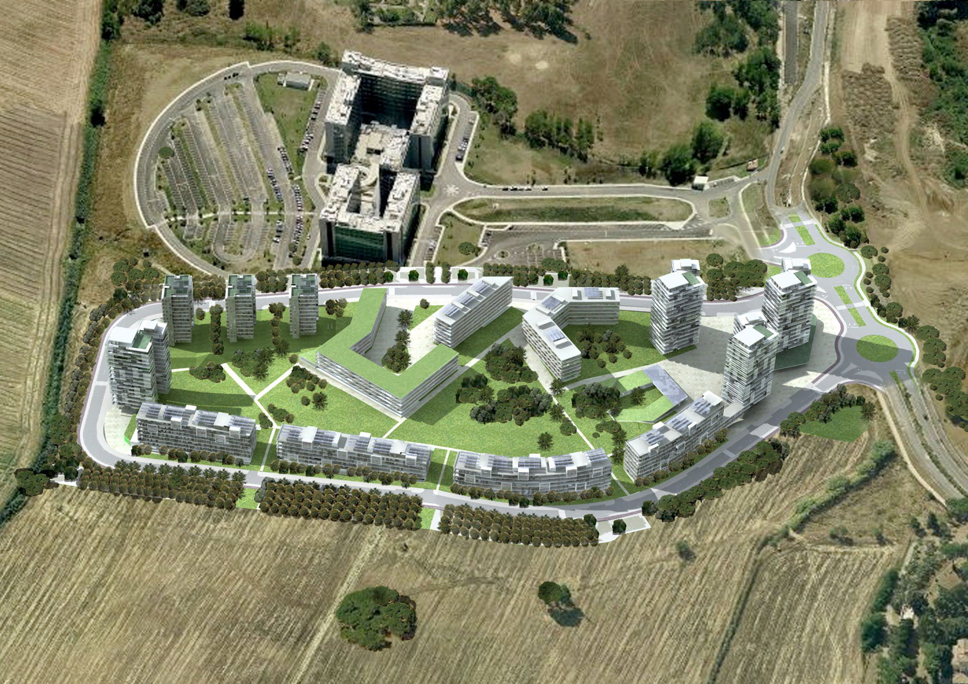
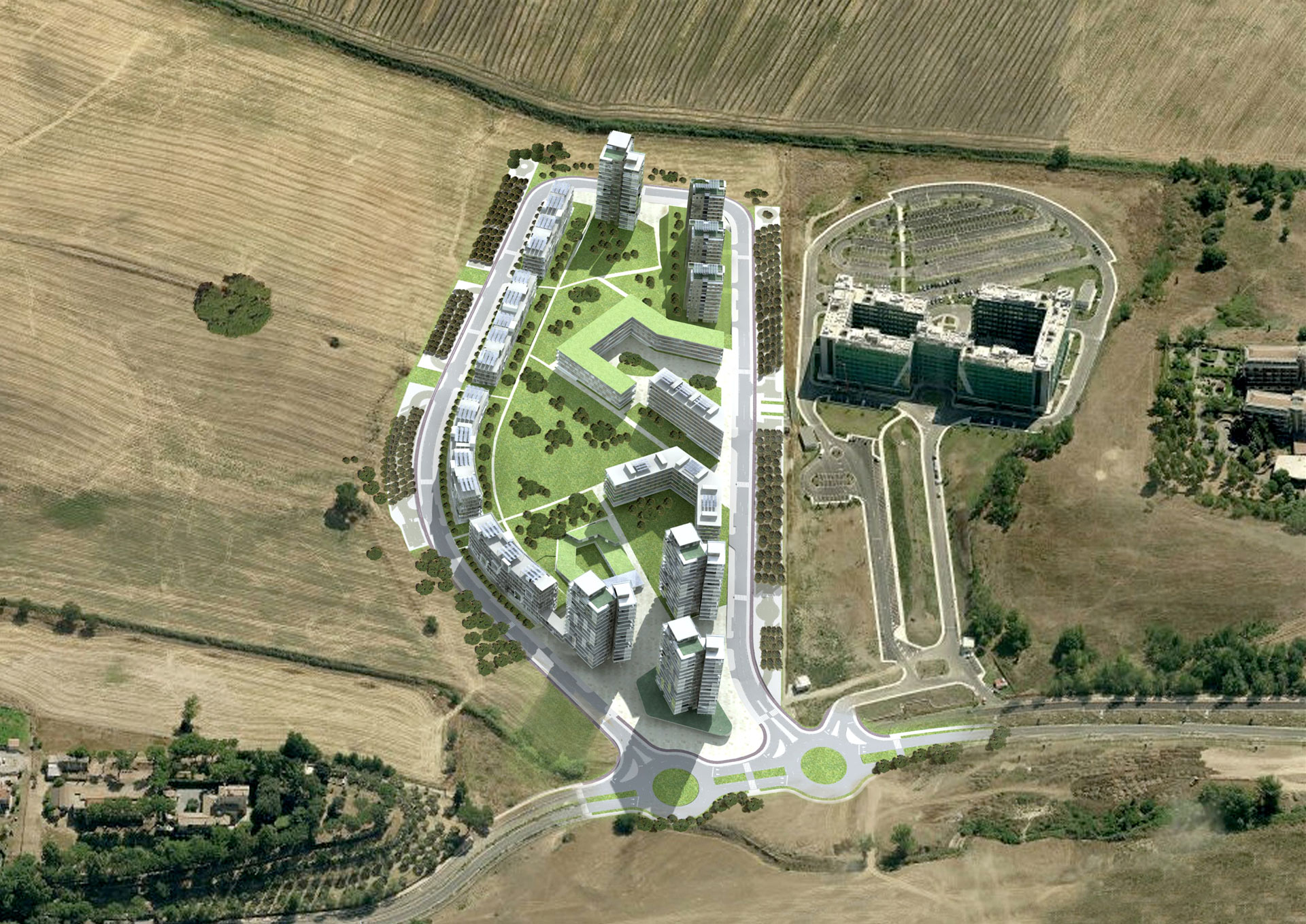
The area covered by this proposed Agreement Program is located near the district of Bufalotta IV in the Municipality of the City of Rome.
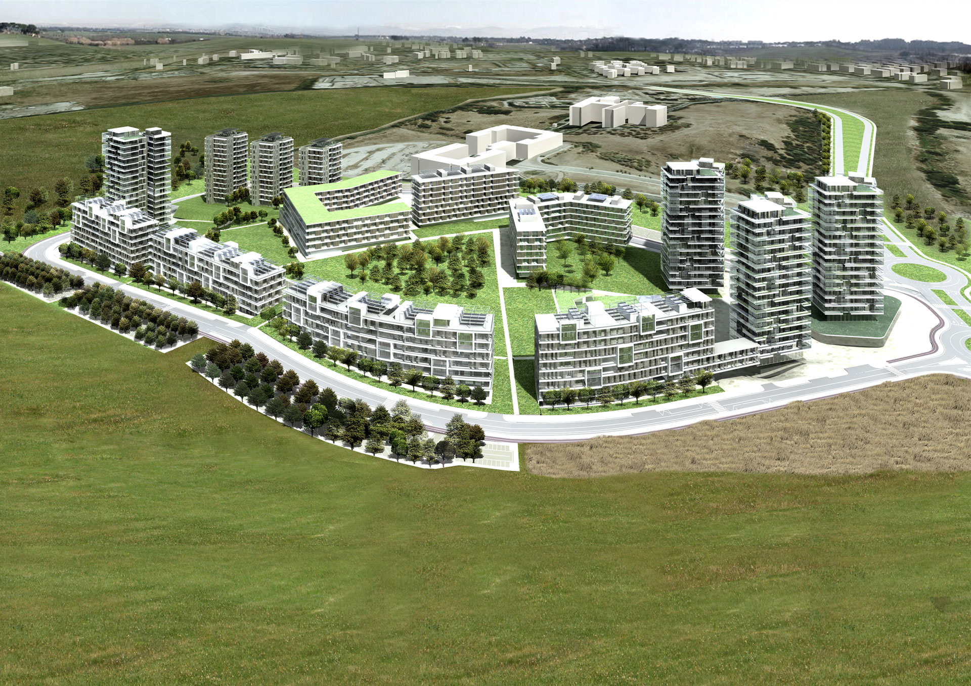
The project based its arguments on the relations established with the context, these are both of a morphological and spatial vision. Not only that tends to build a piece of city open to the sets and systems around and not to identify as yet another “urban fence” closed in on itself, unable to establish relations with the surrounding poles, but to accommodate an internal is the settled population and lives, but also citizens ‘external’ urged to take advantage of the open spaces and functions to the social and collective uses. The relationship with the topography, that is, with the peculiar development of the agricultural year around and with the slope that characterizes the area of intervention, suggests a facility designed to preserve and amplify the characteristics and qualities of the site. The plant morphological condenses volumes on the edge of the lot which, through the construction of the edges, allow to focus and enhance the extensive system of public spaces central, related with the private spaces of public use of the streets in the project, constitute a gravitational pole of reference for the functions located and the local context, edges, equally highlighted by the perimeter road inside the area, the visual relationship with the campaign is direct and unmediated.
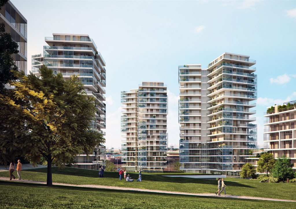
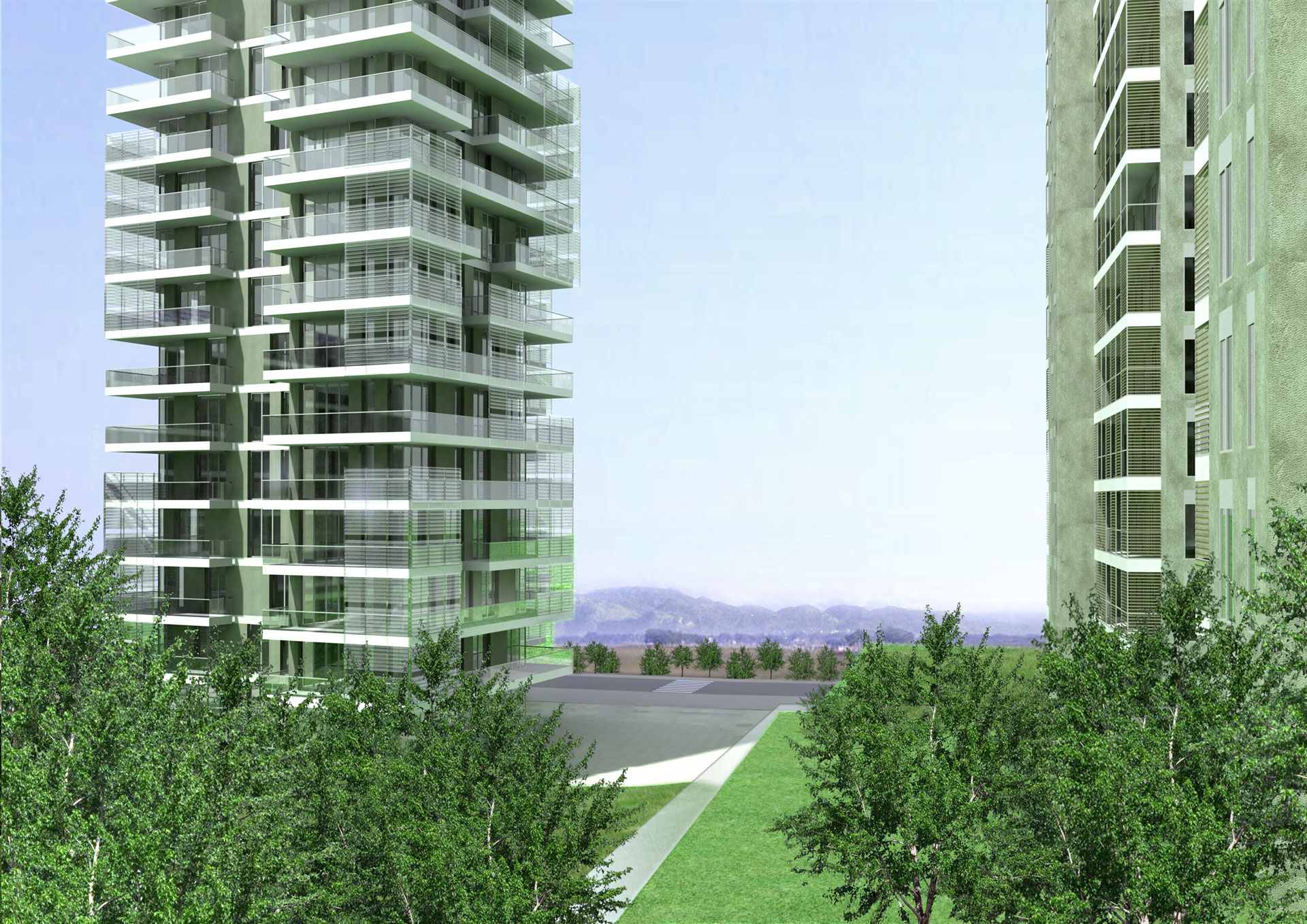
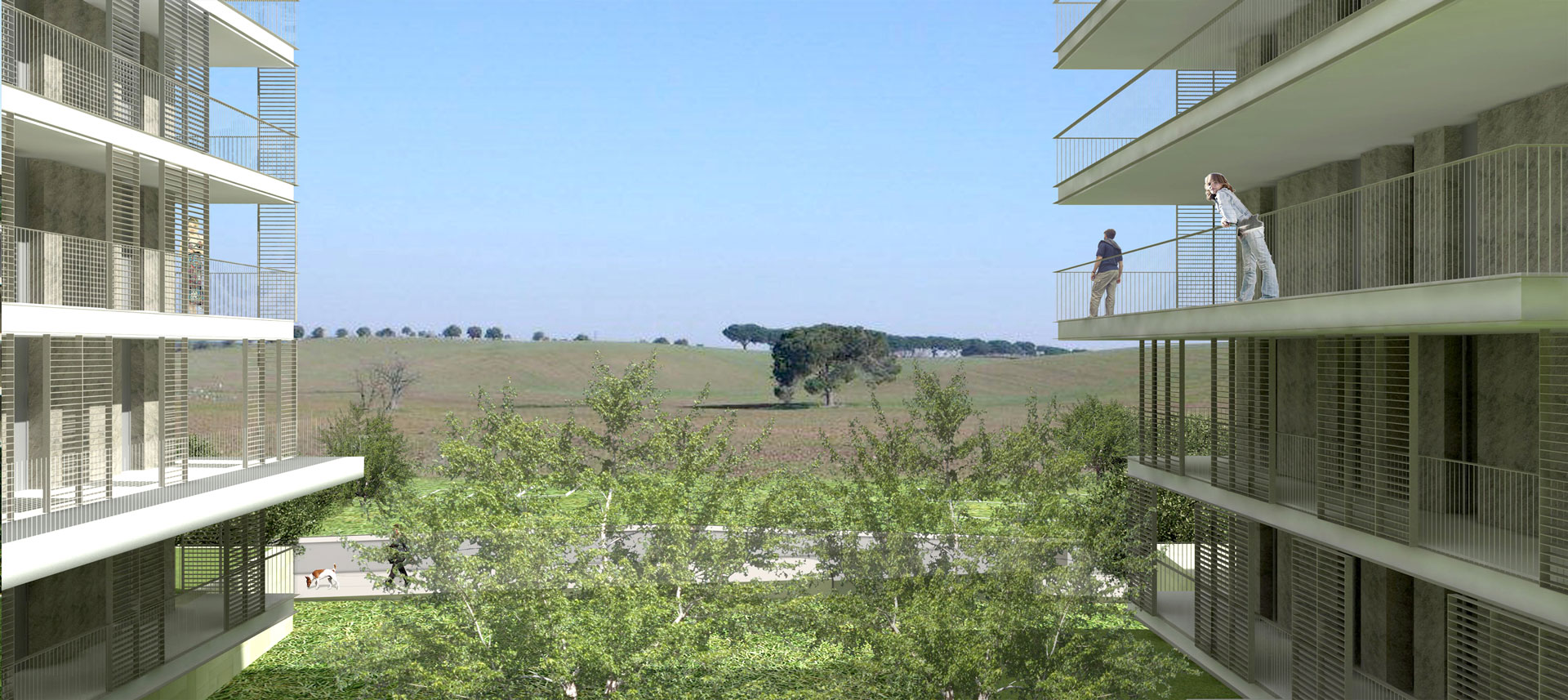
The cones on the visual landscape structure the entire system. The edges building, consisting of dall’intervallarsi compact volumes with buildings in line with each other significantly spaced, allow a concrete permeability to the eye of one who observe the intervention from the neighborhood.
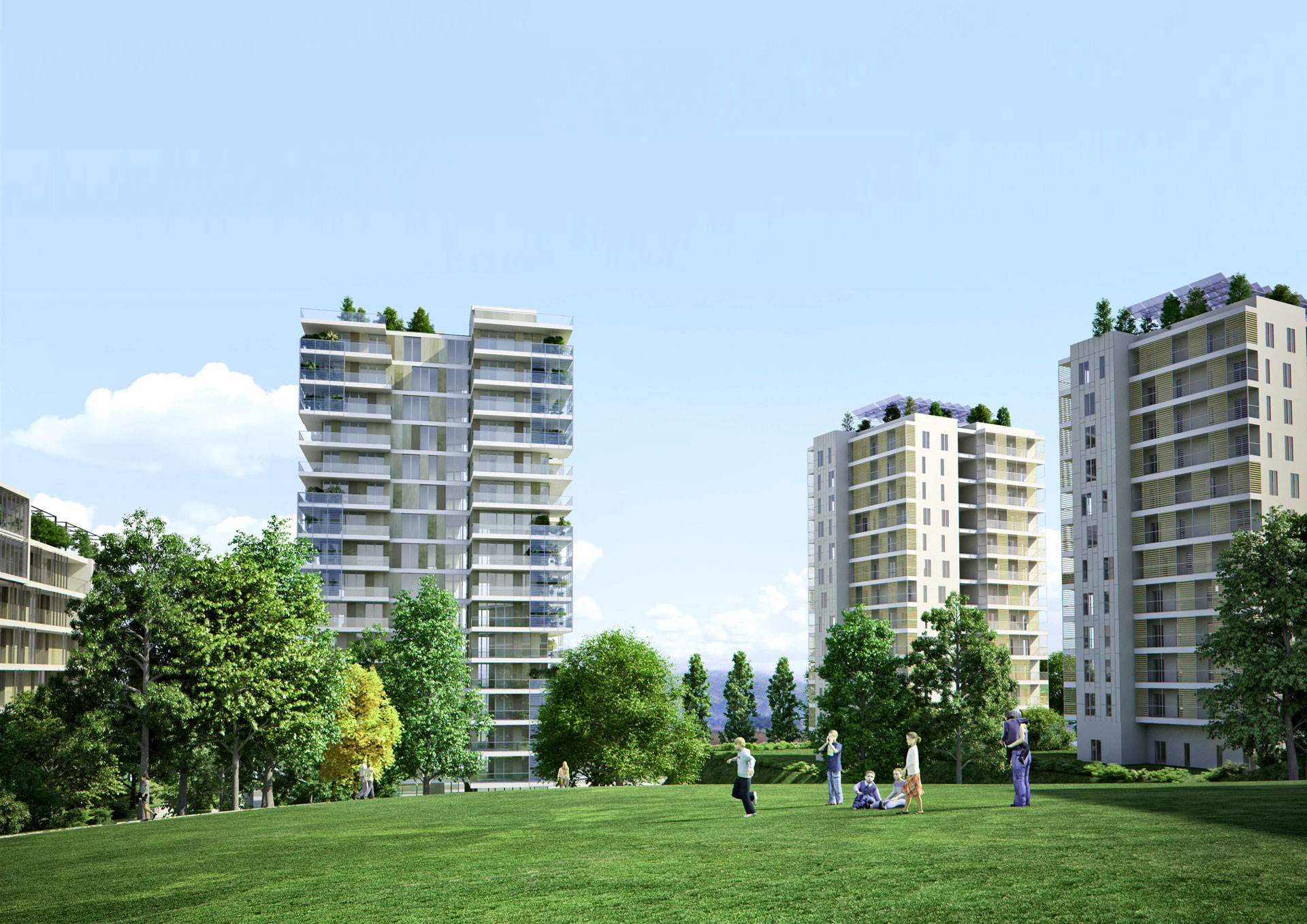
The double edge defines and shapes the large central reservoir, which thanks to its shape allows free passage along the east west, so the slow rise of the hill on one side and the slope on the other allow the gaze to embrace him without interruption, with the only-wanted-interference of the building located on the top, a sort of “Acropolis” is intended to Social Housing, gathered around the central square, built by commercial space and private bathroom.
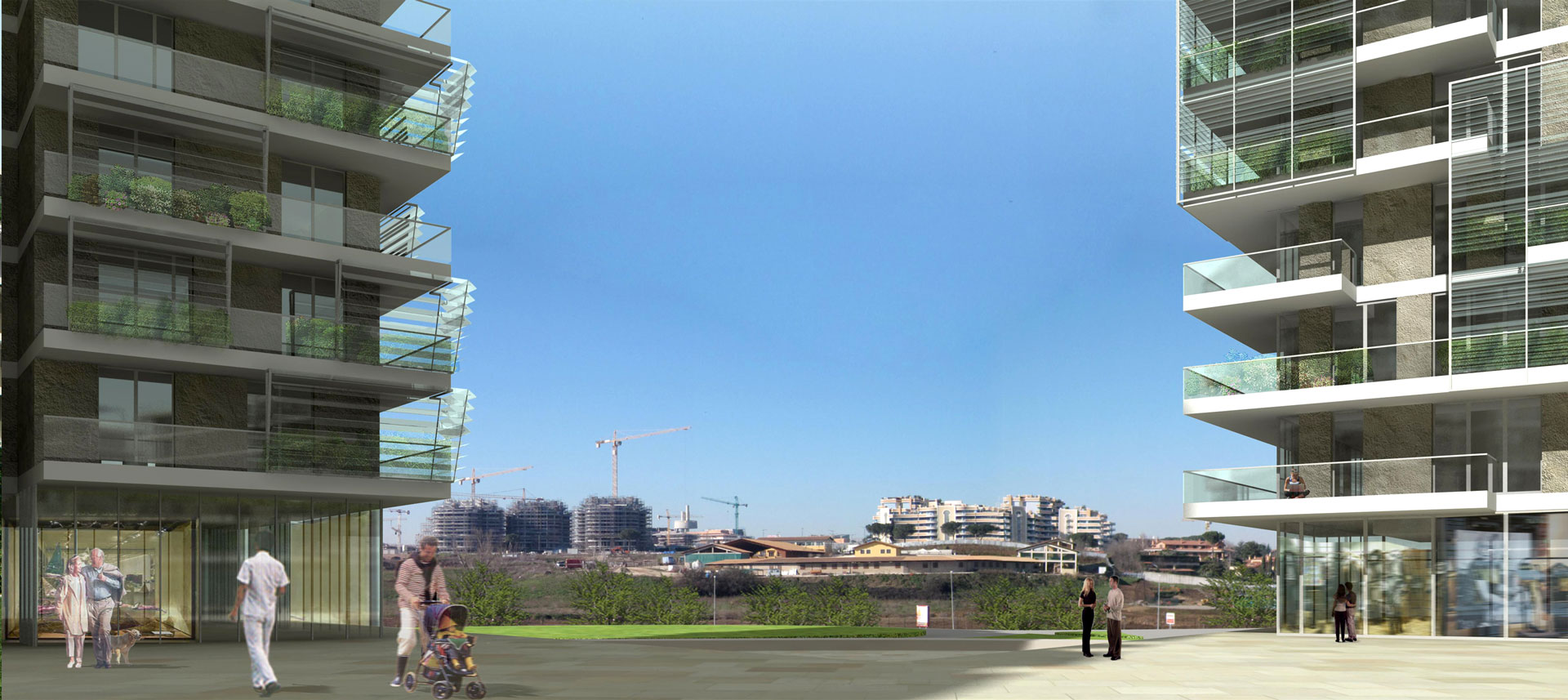
The two building systems in North and South America, despite the morphological differences introduced will suit the lenticular shape of the lot, and ideally converge to the extreme, giving rise to two public squares, with each different role and function: the first related with the West the road that connects the site to the system of territorial infrastructure, a second in the East on the countryside farm.
The first is the “door” of the entire system, on it is surrounded by three residential towers-terminals of the corresponding curtain-building at the foot of which find place in collective activities and commercial spaces. The square to the east is closed by the school complex consists of kindergarten and kindergarten, functional terminal of the park.
The second place plays a markedly more local and is structured by the presence on the ground floors of private services to individuals and / or business located at the foot of the tower overlooking the landscape.
The two squares are connected by pedestrian paths, climbing the hill, are combined in the central square “high”.
The system of public parking is distributed along the perimeter of the settlement and is intended to ensure a smooth service to residences and the business set up. Consisting of compact sets and recognizable flanking the ring road, located under the two public squares two sizeable areas dedicated for stopping in relation to the superficial connective system dedicated to the public.